
S190 Handheld GPS for Hiking
5.0Editor score
Large 3.2 inch display screen
64 GB internal memory capacity
Multi GNSS satellite support available
Navigating through wilderness areas requires reliable tools that can withstand harsh conditions. A handheld rugged GPS navigator with maps ensures you stay on track during hiking camping and outdoor exploration without relying on cell service.
We evaluated ten top models based on display clarity battery longevity and preloaded map data. Our comparison focuses on devices that offer superior satellite connectivity and durability for serious outdoor enthusiasts seeking peace of mind.
Each selection highlights unique strengths ranging from budget friendly options to premium units with satellite messaging. Please note that product availability and pricing can change frequently so verify current details before purchasing your next navigation device.
5.0Editor score
4.3Editor score

4.6Editor score
As an Amazon Associate we earn from qualifying purchases.
The following table provides a side by side overview of the most notable features for each device in our selection helping you quickly identify the right fit for your outdoor needs.




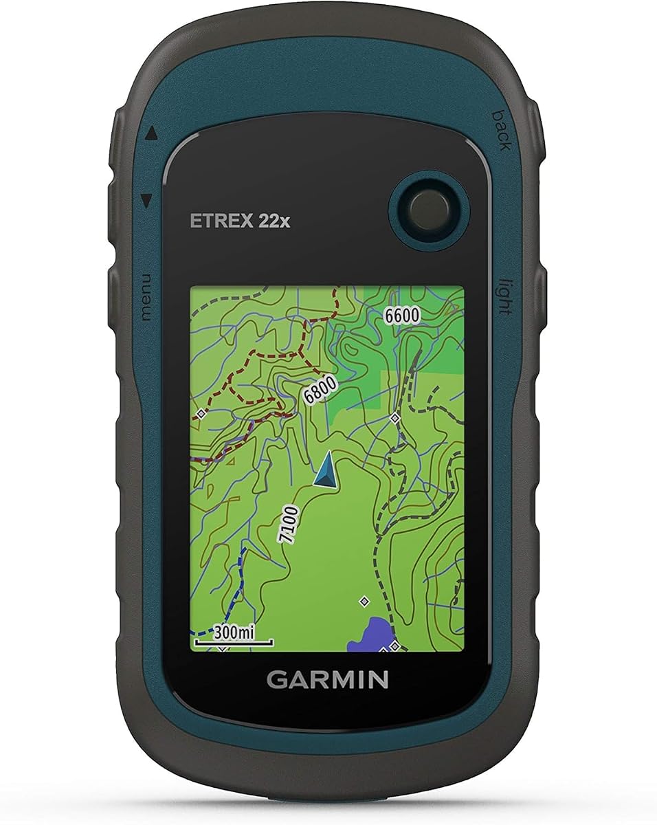
The Garmin eTrex 22x stands out as a reliable choice for outdoor navigation. It holds a solid rating of 4.3 stars from users who value durability and simplicity in the field.
We may earn a commission when you buy through this link, at no additional cost to you.
This unit features a 2.2 inch color display that remains visible even under direct sunlight. It comes preloaded with Topo Active maps that include routable roads and trails for cycling and hiking which saves time on setup.
While it lacks a touchscreen the physical buttons ensure operation even with gloves or wet hands. Battery life reaches up to 25 hours using two AA batteries which is ample for day trips or weekend getaways.
If you need a straightforward rugged navigator without subscription fees this model is an excellent investment. It balances cost and functionality well for those prioritizing core mapping features over advanced connectivity.
The 240 by 320 pixel display provides crisp details for trail markers and topographic lines ensuring you can read your location clearly during critical navigation moments.
Support for both GPS and GLONASS satellite systems allows for tracking in more challenging environments such as dense forests or deep canyons where single system signals might fail.
We may earn a commission when you buy through this link, at no additional cost to you.
The S190 Handheld GPS offers a compelling value proposition for budget conscious adventurers. It has achieved a perfect 5.0 rating in specific reviews highlighting its strong performance at a lower cost.
We may earn a commission when you buy through this link, at no additional cost to you.
Featuring a large 3.2 inch sunlight readable color display this unit makes it easy to view maps and waypoints even in bright conditions. It comes with USA Topo maps and a worldwide basemap which covers most hiking needs immediately.
One of its biggest advantages is the 64 GB internal memory allowing you to download detailed maps for multiple regions without needing external storage. The battery lasts up to 36 hours on a full charge which supports extended expeditions.
Ideal for hikers seeking cost effective navigation without sacrificing screen size or memory this device is worth considering. Just be aware of the zoom limitations on preloaded maps and plan accordingly for detailed terrain viewing.
The rechargeable battery provides up to 36 hours of life which is generous for long weekend trips eliminating the need to carry spare power banks for most outings.
With 64 GB of internal memory you can store extensive map files for different states or countries making it versatile for travelers exploring diverse landscapes.
We may earn a commission when you buy through this link, at no additional cost to you.
The Garmin eTrex 32x builds upon the classic design by adding advanced sensors for better navigation accuracy. It maintains a 4.2 star rating from users who appreciate its robust build and reliable tracking capabilities.
We may earn a commission when you buy through this link, at no additional cost to you.
This device includes a 3-axis compass and barometric altimeter which provide accurate heading and elevation data even when you are standing still. The 2.2 inch sunlight readable color display ensures you can see routes clearly during day or night hikes.
Battery life extends to 25 hours with two AA batteries which is consistent with other models in this family. Preloaded Topo Active maps cover roads and trails making it easy to plan routes without additional setup steps.
Best for hikers who need compass accuracy without the complexity of a smartphone this unit delivers solid performance. While the memory is limited it is sufficient for most standard mapping needs and supports micro SD cards for expansion.
The inclusion of a 3-axis compass allows for accurate heading readings even when stationary which is crucial for navigation in dense forest or mountainous terrain.
The 2.2 inch display is optimized for readability in sunlight ensuring you do not lose your place on the map when lighting conditions change rapidly.
We may earn a commission when you buy through this link, at no additional cost to you.
The Garmin eTrex Touch introduces a modern interface to the rugged category with a 3 inch high resolution color touchscreen. It holds a 3.9 star rating reflecting mixed feedback on usability and price versus performance.
We may earn a commission when you buy through this link, at no additional cost to you.
Users appreciate the ability to swipe and zoom easily to follow routes which mimics smartphone navigation. It comes preloaded with detailed maps showing terrain contours parks and rivers providing comprehensive geographic data out of the box.
The rechargeable battery offers up to 130 hours of life in typical use with satellite systems and multi-band mode making it suitable for long expeditions. The IP67 water rating ensures it can withstand heavy rain and wet conditions.
This model is best for those who prefer touch interaction over buttons in the field. However the higher cost and potential glove limitations should be weighed against the convenience of a responsive interface.
The bright 3 inch high resolution color touchscreen allows for easy swipe and zoom actions making route planning and map viewing intuitive and responsive during daily use.
With up to 130 hours of battery life in standard use and 650 hours in expedition mode this unit supports extended trips without frequent recharging needs.
We may earn a commission when you buy through this link, at no additional cost to you.
The S190 continues to impress with its focus on core mapping features and budget friendly design. Its 5.0 rating indicates high satisfaction among users who prioritize functionality over advanced tech features.
We may earn a commission when you buy through this link, at no additional cost to you.
This device features a large 3.2 inch display that remains readable in various outdoor lighting conditions. It includes preloaded USA Topo maps and a worldwide basemap so you can start navigating immediately upon purchase.
The internal memory supports up to 64 GB allowing for extensive map downloads which is rare at this price point. Battery life reaches 36 hours on full charge ensuring you stay powered through long hiking days.
Best for beginners or budget hikers this unit provides essential tools without unnecessary complexity. Just remember to check map zoom tiers before your trip to ensure you have detailed coverage for your specific route area.
Preloaded with USA Topo maps and a worldwide basemap this device ensures you have immediate access to essential trails and points of interest without needing extra downloads.
Rated IP64 against splashes and outdoor elements this unit offers reliable protection for light rain and dust common in typical hiking environments.
We may earn a commission when you buy through this link, at no additional cost to you.
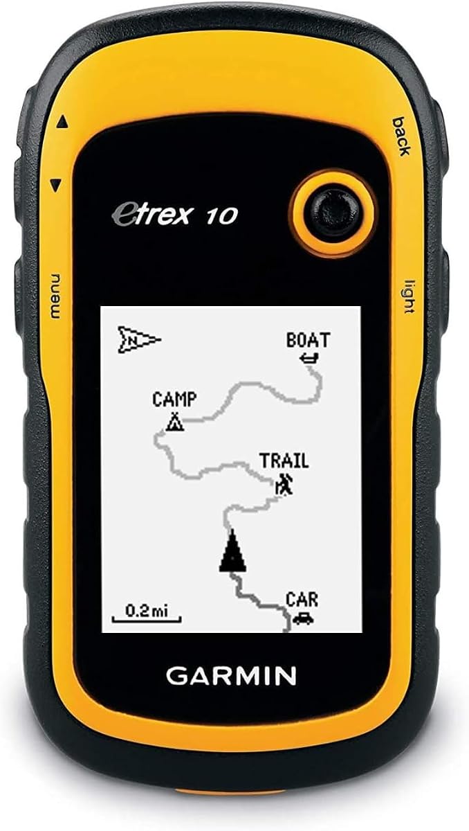
The Garmin eTrex 10 is a classic entry level option for those needing reliable GPS without the cost of color screens. It has a 4.3 star rating from users who value simplicity and worldwide coverage.
We may earn a commission when you buy through this link, at no additional cost to you.
This unit comes preloaded with a worldwide basemap which is useful for travelers moving between regions. The 2.2 inch monochrome display is easy to read and saves battery life extending usage to 20 hours on two AA batteries.
It features a WAAS enabled GPS receiver with HotFix and GLONASS support for fast positioning and reliable signal in varied environments. The design supports paperless geocaching and spine mounting accessories for hands free use.
Ideal for casual hikers or backpackers on a budget this device offers core functionality without extra features. However the monochrome display may lack detail compared to color options so consider your terrain needs before choosing.
The preloaded worldwide basemap ensures you have basic geographic information wherever you travel making it suitable for international adventurers who need immediate navigation tools.
WAAS enabled GPS receiver with HotFix technology allows for fast positioning and a reliable signal even in challenging environments with limited sky view.
We may earn a commission when you buy through this link, at no additional cost to you.
The Garmin Montana 710 offers a large 5 inch glove-friendly touchscreen that makes viewing maps and terrain details exceptionally clear. It holds a 4.3 star rating from users who appreciate its premium build and display size.
We may earn a commission when you buy through this link, at no additional cost to you.
This unit is built to military standards for thermal shock and vibration ensuring it survives extreme conditions. It includes 32 GB of memory to store additional maps and high resolution satellite imagery for detailed overhead views.
Battery life provides up to 24 hours in GPS mode and can also be powered with AA batteries for flexibility. The ABC sensors including altimeter barometer and electronic compass help navigate trails with precision.
Best for serious explorers who need a large screen for complex navigation this unit justifies its cost with durability and features. It excels in environments where visibility and ruggedness are paramount for safety.
The 5 inch glove-friendly touchscreen offers easy viewingability and includes versatile mounting solutions allowing for hands free navigation during activities.
Rugged construction rated to MIL-STD 810 ensures thermal shock and vibration resistance providing reliable performance in demanding outdoor conditions.
We may earn a commission when you buy through this link, at no additional cost to you.
The Garmin eTrex SE focuses on endurance with an impressive battery life of up to 168 hours in standard mode. It maintains a 4.2 star rating from users who prioritize long trips without recharging.
We may earn a commission when you buy through this link, at no additional cost to you.
This model uses two field replaceable AA batteries allowing you to swap power sources easily on the trail. It includes a high resolution display that is easy to read even in bright sunlight for clear map viewing.
Multi-GNSS support gives access to multiple global navigation satellite systems for tracking in challenging environments. The digital compass provides accurate heading even when stationary which is vital for navigation in dense terrain.
If you need a device that lasts weeks on a single charge this unit is ideal. While it lacks modern touchscreen features its simplicity and battery endurance make it a strong choice for long expeditions.
Up to 168 hours of battery life in standard mode allows for extended trips without recharging making it perfect for multi-day hikes and remote expeditions.
Multi-GNSS support gives access to multiple global navigation satellite systems including GPS GLONASS Galileo BeiDou and QZSS for reliable tracking anywhere.
We may earn a commission when you buy through this link, at no additional cost to you.
The Garmin GPSMAP 67i offers top tier safety features with inReach satellite technology for two-way messaging and interactive SOS. It holds a 4.6 star rating from users who value emergency connectivity and reliable navigation.
We may earn a commission when you buy through this link, at no additional cost to you.
The device enables location tracking via the Iridium satellite network which covers 100 percent of the globe. You can trigger an SOS to a 24/7 staffed emergency response center ensuring help is on the way if needed.
It features a large 3 inch sunlight readable color display for easy viewing and multi-band GNSS support for optimal positional accuracy. Battery life extends to 165 hours in tracking mode supporting long expeditions.
Best for solo adventurers or those exploring remote areas this unit provides critical peace of mind. While it requires a subscription for messaging the safety features make it a worthwhile investment for high risk outdoor activities.
Trigger an interactive SOS to a 24/7 staffed emergency response coordination center ensuring you can get help even when far from cellular coverage.
Enable two-way messaging and location tracking via the Iridium satellite network which lets you stay in touch with friends or family during remote trips.
We may earn a commission when you buy through this link, at no additional cost to you.
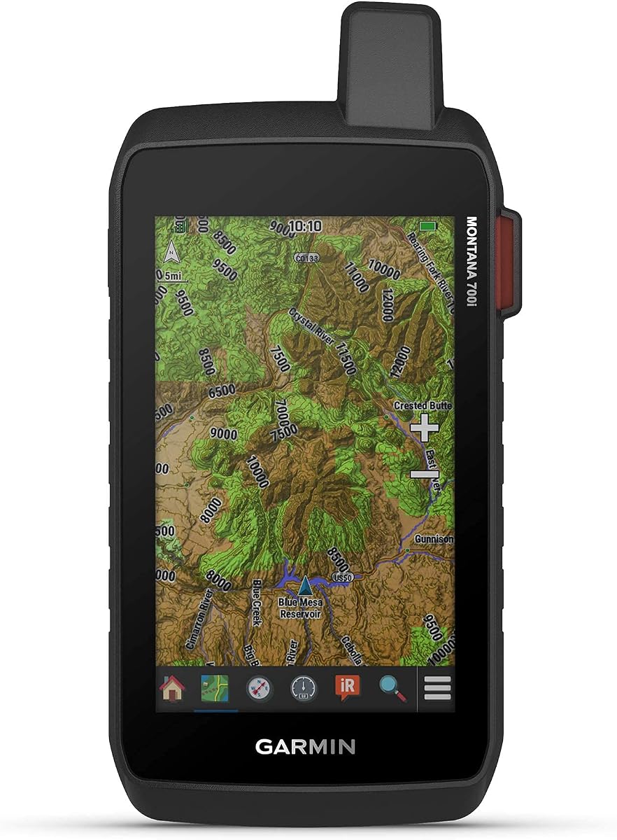
The Garmin Montana 700i combines a large 5 inch touchscreen with integrated inReach satellite technology for communication. It has a 4.0 star rating from users who appreciate its versatility and connectivity options.
We may earn a commission when you buy through this link, at no additional cost to you.
This unit triggers an interactive SOS to a 24/7 monitoring center using the Iridium satellite network for two-way messaging. It features preloaded TopoActive maps and navigation sensors for precise route tracking.
Connectivity includes Wi-Fi Bluetooth and ANT+ allowing direct access to satellite imagery downloads and app support. The rugged military-grade construction ensures durability during tough outdoor activities.
Ideal for users who want advanced mapping and safety in one device this model is powerful. Ensure you have a subscription for satellite features to fully utilize the messaging capabilities on long trips.
Pro-connected with ANT+ technology Wi-Fi connectivity and BLUETOOTH wireless networking giving you direct-to-device access to downloads and location sharing.
Features rugged military-grade construction and a 5 inch touchscreen display that is 50% larger than the previous model offering easy viewability for detailed maps.
We may earn a commission when you buy through this link, at no additional cost to you.
Selecting the right navigation device requires understanding your specific outdoor needs and technical requirements for performance in the field.
Look for a sunlight readable screen that remains clear in bright conditions as visibility is critical when you need to read maps quickly. Larger screens help see terrain details but may add weight to your pack.
Prioritize color displays for better map interpretation and ensure the size fits your hands comfortably for long trips.
Battery duration determines how long you can travel without recharging so choose a model that matches your trip length. AA batteries are convenient for replacements while rechargeable units reduce waste.
Always carry spare power options if you plan to stay out for more than one day without access to a power source.
Preloaded Topo maps provide essential trail data without extra costs so verify that the device covers the regions you intend to visit. Internal memory capacity impacts how many maps you can store locally.
Check if the device supports micro SD cards or Wi-Fi downloads to expand your map library as your adventures change.
IP ratings indicate water and dust resistance which is vital for harsh weather or accidental drops during outdoor activities. Look for units rated IPX7 or higher for reliable protection against rain.
Military standards like MIL-STD 810 offer additional assurance against shock and vibration for extreme environments.
Multi-GNSS support including GPS GLONASS and Galileo ensures accurate positioning in difficult terrains like canyons or dense forests. More systems mean better lock speed and reliability when signals are weak.
Verify that the device uses these networks to track your location consistently without losing signal often.
Built-in sensors like 3-axis compasses and barometric altimeters provide precise heading and elevation data even when stationary. These are helpful for navigating without a clear view of the sky.
Ensure the device calibrates sensors properly so your readings remain accurate throughout the duration of your trip.
Features like Bluetooth and Wi-Fi allow you to sync routes or download new maps without a computer. This flexibility is useful for updating maps before heading out for a new adventure.
Check compatibility with smartphone apps for trip planning and review before buying to maximize utility.
Compare features against your budget to find a device that offers necessary functions without unnecessary costs. Premium models may include satellite messaging but basic units suffice for day hikes.
Invest in a model that balances cost with the performance features you will actually use on regular trips.
Start by charging the device fully or inserting fresh batteries before heading out. Download detailed maps for your destination area using Wi-Fi or an SD card if needed for better navigation accuracy.
Turn on the GPS and allow it to acquire satellite signals by holding it flat in an open area. Familiarize yourself with the buttons or touchscreen to mark waypoints and track routes as you hike.
After your trip clean the device with a soft damp cloth and store it in a dry place. Regularly check for software updates and ensure sensors are calibrated for continued reliability in the field.
Most units in this list feature water resistance ratings like IPX7 or IP66 which protect against rain and splashes. Always check the specific rating to ensure it meets your conditions before use.
Yes all these handheld GPS navigators rely on satellite signals not cell towers to track location. This makes them ideal for remote areas where phone service is unavailable.
Battery life varies from 20 hours to over 100 hours depending on the model and usage. Longer lasting models often use AA batteries or rechargeable packs for extended expeditions.
Many devices support SD cards or Wi-Fi downloads to add new maps after purchase. Check the specific model compatibility before buying extra map files for your region.
Multi-GNSS support allows the device to use multiple satellite networks for better accuracy in challenging environments. This improves signal reliability in dense forests or deep canyons.
Most models include preloaded TopoActive or worldwide basemaps for immediate use. Some may require a subscription for premium map content or extra regional details.
We highlighted top choices from budget friendly options to premium units with satellite messaging for different needs. Each device offers unique strengths in display battery life and mapping features to suit outdoor styles.
Prioritize features that matter most to your adventures like battery endurance or compass accuracy. A device that balances cost and performance will serve you best over the long term.
Always verify current pricing and availability before buying as these values change frequently. Use this guide to narrow down options that fit your specific hiking or exploration goals effectively.